

There is a reason
the Going to the Sun Road
should be on
every cyclist’s bucket list.
Bags out at 6:10 am. That was the mandate from the Backroads trip leaders the morning we were to bike to Logan Pass on the Going to the Sun Road.
We were learning to be pampered on our trip to Glacier National Park. It was day two of our trip and the routine could not have been simpler. Get up, put your bags in the hall so Backroads could pick them up, eat breakfast and ride your bike.

The Roanoke Group in a paceline on the early stretches of the Going to the Sun Road
But there were two challenges this day. One was climbing the mountain, the other getting up so early. I’m not a big fan of 5 a.m., but if we wanted to do this ride we had to be on the road early enough to get up and down the mountain by 11 am – the time authorities have deemed that there is no longer room for both bikes and cars on the popular highway.
On the other hand, for me this was to be the highlight of the trip. This was it, the automatically epic ride. The iconic, top 10 on any list, ride-your-bike thing to do. So getting up at the crack of dawn was a reasonable price to pay. It didn’t hurt that dawn in Glacier comes early because of it’s northern fix on the map – so at least there was daylight.
Our group from Roanoke had designated this day to wear the custom jerseys and wind jackets designed by Andy Beedle, a member of our cycling group which was about to attempt the 42 mile out and back ride.
Brandon and Katie, our Backroads trip leaders gathered us together at a picnic table. They laid out cold cuts and other goodies so we could assemble our sandwiches for later in the day. They also provided high nutrition snacks and energy bars for the ride ahead. We had skipped breakfast in order to get an early start, but there was more than enough food. I opted for a Clif Bar, a banana and a handful of peanut M & M’s.

Andy Beedle, Gretchen Weinnig, Gary Butcher, Barbara Butcher, Porter Peery, Katharine Wells, John Carlin, Mary Carlin, Steve Ruhf and Karen Deer in matching cycling jerseys and wind jackets designed by Andy Beedle. We designated this day as the day to wear them.
Our group included the ten of us from Roanoke, a similar sized group from New England, and several other couples. Those who wanted to ride the entire route were free to do so, but Backroads would provide shuttle service to anyone who wanted to do only the second half (and less steep portion) of the climb. Some members of the group at large planned to pass on this ride and enjoy the scenery from the van, but all ten in our Roanoke group opted to pedal.

The view along Logan Creek in the early miles.
After taking a photo in our matching cycling kits, we headed off on the first flat-ish miles of the ride, mindful of the warning that we MUST be off the road by 11 a.m. That meant we had roughly four and a half hours to climb 4200 feet over 21.5 miles and descend back to the hotel. Piece of cake, right?
Below are two very quick video clips that show our progress on the lower stretches.

Craig Stevens, David Duhaime, Jim English and Mat Szilard on the lower stretch of the G2S Road
The ride started out easily from Lake McDonald Lodge. The first ten miles was both easy and beautiful as we rode along the crystal clear Logan Creek. There were lots of trailheads for hiking and despite the early hour, a good number of cars were parked at many of them. At this point the scenery was all above us. We were still below 3,600 feet while the mountains around us towered well over 8,000.
 We rode in a paceline during much of this portion of the ride, pulling into the occasional over look for pictures. Most people carried only their cell photos for photos. A few carried pocket digital cameras, and I stubbornly lugged along my Canon 7D DSLR camera in the padded cargo “trunk” affixed to rack over the rear wheel.
I knew there would be a lot of climbing, and that the camera, which weighs several pounds, might be like towing an anchor up the mountain. But the prospect of the views and the possibility of seeing mountain goats, big horn sheep and perhaps a black or grizzly bear was more than I could stand. Besides, I reasoned the camera would force me to be mindful of the fact that I was not here to see how quickly I could climb the mountain. It would force me to look up and enjoy the scenery along the way. 
How terrible to ride the Going to the Sun Road, only to focus on the pavement in front of my wheel and hear my labored breathing as I tried to conquer the climb. It wasn’t long before I realized that would not have happened anyway.

Group selfie with Karen Deer, John Carlin, Mary Carlin and Porter Peery.
I don’t think any of us were prepared for the beauty that began to unfold as we gained elevation. At ten miles, the road pitched up to about 7-percent, which while challenging, is similar to the training rides we had done on the Blue Ridge Parkway in Roanoke. And though the grade made it impossible to ignore the physical challenge in front of us, the grandeur of the scenery trumped it many times over.
We pulled off the road in several places, where the Park Service had cleared the trees to provide views of the surrounding mountains and waterfalls. I was already reaching regularly for the real camera and happy I had brought it along. This was especially true as we passed through a tunnel that had been blasted through the mountainside. Looking back at the opening from above, I could see the tunnel on my left, and an indescribable vista on my right. Andy Beedle was not far behind me, so I waited to click a photo of a cyclist in the middle of this scene. It turned out to be one of the better pictures of the trip.

Andy Beedle emerges from a tunnel on the Going to the Sun Road
Miles 10-13 or so were difficult, but with every bit of elevation gain, the views became even more spectacular. It was impossible to know when to stop and take a picture, and when to just drink it in. There was no way to photograph all of it. And because of our time limit, stopping had to be limited to only the best spots. These were difficult decisions.

This is the view just behind the fun group selfie above. We were looking up at near where we would soon be riding. Note the waterfall in the middle.

Jim English and David Duhaime turn the corner at the “swoop.”
By now the highway had transitioned from a valley road along the creeks to one that followed the ridge line, and while there were still high mountains around us, there were also dramatic valleys that dropped off beside the road. The view down was as magnificent as the look up. At 13.2 miles the road does a big swoop and doubles back on itself. From here, we could see more of the way ahead as it hugged the cliffs from which the highway was chiseled in the 1930’s. Our guides said the grade tilted back to about five percent after the loop and to expect easier riding.
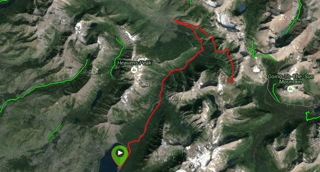
The satellite GPS view shows the swoop in the route.
I will say that the riding felt easier just as suggested, but the course profile from my Garmin showed the same, steady climb. No matter. We were just below the Continental Divide, meaning rain on one side of the mountain flowed to the Pacific, while anything on the other side found it’s way to the Mississippi and the Gulf of Mexico. When you are that high up, there’s a lot to see, and it’s easy to forget you are pedaling uphill.

The course profile from my Garmin shows a classic out and back image. Click here to see the actual, interactive post at Garmin Connect.

A view shortly after the swoop.
I had been stopping often to take pictures and as a result many members of the group had passed me, including my wife, Mary. We were in Montana to celebrate our 30th wedding anniversary and I began to panic, thinking that I had come here to see these amazing sites with her — and yet she was probably a mile up the road.
I decided that I had to catch her so we could enjoy at least a few miles of side-by-side riding. With that in mind, I put the camera away and began riding at a pace I would describe as “tempo” — harder than usual – but not all out. There was still a lot of climbing ahead and I didn’t want to blow up. The task of climbing the G2S Road (as it is sometimes abbreviated) certainly had my respect.

Mary Carlin at an overlook.
Somewhere around the 15 or 16 mile mark I spotted Mary at an overlook. She and friend Karen Deer had pulled over to enjoy the view and get a boost from an energy gel. I was relieved to have caught them, and we snapped a few pictures before heading back up the road.

Mat Szilard of Rochester Hills, Mi and Craig Stevens of Narberth PA on the G2S Road.
I’m quite certain the road was narrower here than it was down below. Either that, or it just seemed like it, with vertical rock walls on the left, and a drop of hundreds, if not thousands of feet on the right. Workers had used stones from the road’s construction to create make-shift guard rails, but it looked to me like they were too low to stop a car from going over. Perhaps for that reason, traffic was slow and courteous to cyclists. At that time of morning — traffic was reasonably light but it was steady. Although I was breathing hard and making my way up the mountain under my own power, I actually felt sorry for the people in the cars and shuttles. It seemed that they were somehow removed from this beautiful landscape, while I was a part of it. They would no doubt enjoy the scenery, but we on bikes were able to reach out and touch it. If they were tourists, we were perhaps travelers – spectators still — if only a smidgen less.

Mary and Karen Deer pedal along the edge of the road.
As we broke out into the open after the loop, the mountains and waterfalls we had seen from below were not above us but across from us as the road climbed above the valley below. I had no idea we would literally be ascending into the post card like scenery we had been photographing just a few miles before.
At mile 18 we approached the weeping wall. On this day it was dry-eyed. But in the spring as the snow is melting, the embankment on the left side of the road is a waterfall, created when workers blasted the rock to create the roadbed, opening natural veins of water in the mountainside. We saw the intricate water management system the Park Service built to keep the road from washing out, but in August there was barely a trickle emerging from the hillside.
It’s worth noting that our view was hazier than we would have hoped due to smoke from the Reynolds Creek fire, which as of this writing, had burned about 4,300 acres. We were not seeing smoke exactly, but more of a haze not unlike what we see everyday in Virginia’s Blue Ridge Mountains. I lamented the fact that my pictures would not have the clear, crisp views that other photographers achieved.

The haze obscured the view, but it was still breathtaking.
I’ll write more about the wildlife later, but it was about now that my jinx (for this trip anyway) was becoming apparent. Not only was I scanning the landscape for the perfect shot, I was hoping as we neared the top, that I would finally be able to use the heavy zoom lens I’d hauled up the road to capture an image of mountain goats or a big horn sheep standing on a rock outcropping. The higher we climbed the greater the likelihood of seeing one, but none came into view.
At 20.6 miles my hopes for that perfect shot reached a peak when we passed a sign that read: Mountain Goat Study Area. I slowed briefly and scanned the rocks but saw nothing. Up the road just half a mile however was the Logan Pass Visitor Center — the very top of the Going to the Sun Road at 6,680 feet. Several members of our group had already arrived, and with the clock ticking, I pedaled on up to where our group was gathered around the Backroads van.

Members of our group gathering at Logan pass.
Within in about 15 minutes the entire Roanoke contingent had reached the top and we all posed for another photo with the visitor center and the American and Canadian flags waving in the background.

Outrage out west — mission accomplished.
The visitor center is extremely well done, with lots of photos and great information about the engineering marvel that is the Going to the Sun Road. We enjoyed learning more about the wild flowers we had seen as we climbed from the lush green valley below to the stark, rocky pinnacle where we now were standing.
Normally, riders on our trip would re-mount their bikes and continue down the backside of the mountain for the 13-mile descent to Saint Mary on the Park’s eastern boundary. On this day the road was closed so firefighters could use it to access the Reynolds Creek blaze. So our orders were to go back the way we came and return to Lake McDonald Lodge.

Later in the day we would ride past the encampment for the firefighters working the Reynolds Creek fire. It was easy to see why they needed the back half of the Going to the Sun Road for access, but it was sad we had to shuttle 2-3 hours to get around the road closure.
Though I consider myself a better than average descender, I had been intimidated by the sheer drop offs beside the road on the way up. In addition, I wanted one more peek at the “Mountain Goat Observation Area” a half mile down the mountain. So while my friend and usual downhill partner Gary Butcher took off to attack the road, I pulled over to look for mountain goats, as several other, more cautious riders passed me riding their brakes in Gary’s wake.
Alas, the goats were in hiding, and the clock was ticking, so I pointed the bike downhill and prepared to enjoy a leisurely descent. I was doing pretty well holding back until I got behind a mini-van doing only about 15 miles per hour. Not only was it obscuring my view, but it was forcing me me watch it, and not the scenery. In addition I felt like I could cruise comfortably at about about 25-30 mph – which was faster than the van. Soooo…. When the road opened up a bit, I passed it.

Karen Deer rides up. It looked a whole lot different coming down.
This was getting to be fun! The wind in my face, the scenery all around me, and the road – at least here — straight enough that I felt no fear of seeing the edge of the precipice on my left with that none-too-comforting natural guard rail. Soon I spied some other members of our group, so I tucked a little. Still not feeling like I was pushing the envelope, I caught them in no time. I said hello and moved on till I came to a park shuttle. Same problem as the mini-van, only now there were motorcycles behind me facing my same problem. Once again the road straightened out and once again I eased past. Steve Ruhf, of Lynchburg was watching from behind and says the motorcyclists were none too pleased with me, thinking I took their opening. He also claims I shot a gap near a construction zone and he believed I was going to endo onto a tour bus as it passed on the roadway several hundred feet below. I think he was exaggerating. There was no tour bus.
On it went like this down the steep part of the road. It was like coasting through the most beautiful post card on earth. I passed a few more slow moving vehicles and even a motorcycle. It was among the most fun I have had in my entire life.

Toward the bottom where the road flattened out, I pulled over and took some photos of Logan Creek while the rest of the group made the descent. We re-grouped and rode in a paceline back to Lake McDonald Lodge. I think It might have been a couple of minutes after 11:00 a.m. – but we were well away from the highly trafficked section of the road and I believe within a reasonable grace period relative to the curfew. At any rate, no one seemed to notice that we were a couple of minutes late.
Looking back
So often in life we build our expectations to the point that the only outcome can be disappointment. We read about a planned event or visit. We count the months, weeks and days until whatever it is happens. Then when it comes, there is no way it can equal our anticipation. For months my wife, Mary and I anticipated our trip to Glacier National Park with our close group of friends. I had heard so much about this particular day of the trip and how over the top it could be, but I wondered how much of that was hyperbole. I was prepared to be underwhelmed. Nothing, I reasoned, could live up to that amount of hype.

Man, was I wrong. The road, the scenery, the people with whom we rode — all of it. The Going to the Sun Road exceeded my expectations, and there truly is a reason it should be on every cyclist’s bucket list.


Article Comments